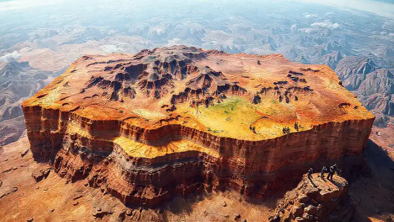
The study of dinosaurs and their environments relies heavily on the preservation of fossil sites. These sites are incredibly fragile and vulnerable to damage from human activity, erosion, and even natural disasters. Protecting these locations is a complex undertaking that requires meticulous research and careful planning. Understanding the geological context surrounding a potential fossil site is paramount, which is where the vital role of geological maps comes into play. They offer a crucial window into the past, revealing the history of the land and increasing the likelihood of finding and securing significant paleontological treasures.
The process of discovering and conserving dinosaur fossil sites isn’t simply a matter of digging; it’s a carefully orchestrated blend of scientific investigation and preservation strategies. Without a solid understanding of the geological history of an area, researchers risk overlooking valuable clues and, even worse, inadvertently damaging or destroying potential paleontological resources. Therefore, the initial step in many projects is to analyze existing geological data, starting with detailed maps that represent a foundational tool for paleontologists and conservationists.
Geological Mapping Techniques
Traditional geological mapping relies on a combination of fieldwork and laboratory analysis. Geologists meticulously survey an area, documenting rock formations, mineral deposits, and any visible evidence of past geological events like faults or volcanic activity. This data is then compiled into a detailed map, often using colored overlays to represent different rock layers and geological structures. Sophisticated techniques like stereoscopic aerial photography and LiDAR (Light Detection and Ranging) are increasingly used to create high-resolution digital maps, improving the accuracy and detail of the geological record.
The resulting maps aren’t just pretty pictures; they're incredibly powerful tools for interpretation. By analyzing the sequence of rock layers, geologists can reconstruct the geological history of the area, determining the relative ages of different formations and identifying periods of uplift, erosion, and deposition. This information is then used to predict where fossil-bearing sediments are most likely to be found – areas where older rocks have been exposed by erosion. It’s a painstaking process, but absolutely critical for effective site identification.
Identifying Paleontological Zones
Paleontological zones are areas where the specific characteristics of the rock formations indicate a higher probability of fossil discovery. These zones are often defined by the presence of certain sedimentary layers, such as sandstone, siltstone, or mudstone, that have accumulated in ancient river channels, lakebeds, or coastal environments. Geological maps, combined with paleontological knowledge, allow researchers to pinpoint these zones with greater precision.
Furthermore, understanding the types of fossils that are typically found in specific geological formations is essential. For instance, a map showing Jurassic-aged sandstone formations might suggest a greater chance of finding dinosaur fossils compared to a map showing only shale. The combination of regional geological data and targeted paleontological surveys – informed by the map – maximizes the chance of uncovering significant discoveries. It’s a strategy focused on probability, not certainty.
Site Protection and Management Plans

Once a promising fossil site is identified, a comprehensive site protection and management plan must be developed. This plan considers several factors, including the fragility of the site, potential threats from human activity (such as off-road vehicles or construction), and the need for ongoing research and monitoring. Regulations and land use plans are crucial to restrict activities that could disturb the fossil record.
Effective protection strategies might involve establishing buffer zones around the site, limiting access to authorized personnel, and implementing measures to control erosion and vegetation growth. Long-term monitoring programs are also essential to track any changes to the site and assess the effectiveness of conservation efforts. These plans should be regularly reviewed and adapted as new information becomes available – demonstrating a commitment to sustainable conservation.
Remote Sensing and Digital Mapping
The advent of remote sensing technologies has revolutionized the way paleontologists identify and monitor fossil sites. Techniques like satellite imagery and drone-based mapping provide a broader perspective, allowing researchers to identify potential sites that might be obscured by vegetation or difficult to access on the ground. Digital elevation models (DEMs) derived from LiDAR data can reveal subtle topographic features, such as ancient river channels or coastal terraces, that are often indicators of fossil-bearing sediments.
Digital mapping also facilitates the creation of interactive databases that integrate geological, paleontological, and environmental data. These databases can be used to share information among researchers, land managers, and the public, fostering collaboration and promoting responsible stewardship of these valuable resources. The ability to quickly and easily analyze vast amounts of data has become an indispensable tool in the modern era of dinosaur conservation.
Conclusion
Dinosaur fossil sites represent a unique window into the past, offering invaluable insights into the evolution of life on Earth. Protecting these sites requires a collaborative approach that integrates geological expertise, paleontological research, and effective conservation strategies. Understanding the relationships between geological formations and fossil distributions, as revealed through detailed geological mapping, is absolutely key to successful site identification and long-term preservation.
Ultimately, the goal of dinosaur conservation is not just to safeguard fossils, but to ensure that future generations have the opportunity to study and appreciate these remarkable remnants of prehistoric life. By prioritizing careful planning, utilizing cutting-edge technologies, and engaging with local communities, we can strive to preserve these invaluable heritage for years to come, ensuring that the story of the dinosaurs continues to be told.
 What techniques are employed for DNA damage repair
 Which dinosaur figurine represents the latest Stegosaurus find
 Which recent discoveries changed Triceratops’ depictions
 What specific threats endanger fossil site preservation
 How do paleontologists use radiocarbon dating
 How are comparative dinosaur anatomies used in phylogenetic studies
Deja una respuesta